The term Geographic Information System (GIS) refers to a computer-based information system designed to link a database with spatial or geographic coordinates, such that it can be portrayed in a map format. This provides an excellent forum for analyses and presentations. HydroQuest uses GIS technology in courtroom and other presentations, as well as in reports and affidavits.
Watershed Delineation
Questions We Can Answer
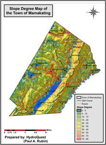
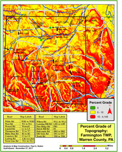
How steep is the slope on parcel of land?
In what direction will contaminants move?
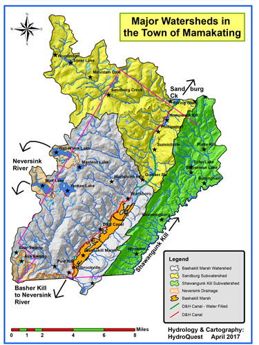
What is the physical extent and size of the watershed up-gradient of a supply well?
Where is the best place to excavate for mineral extraction?
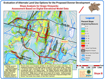
Based on soil qualities, where should I purchase land for my vineyard?
What is the best route for rescuers to take to a mountain crash site?
Where in our city are crime rates highest?
Are earthquakes prevalent near the proposed dam site?
How far has the white-nose bat syndrome spread in the United States?
How has community character changed through time?
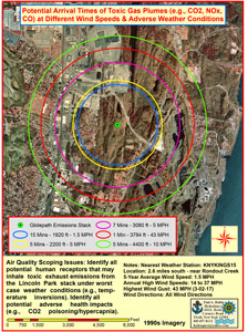
Where can we reroute a proposed gas pipeline away from our community?
Services Include
Professional GIS Map Construction
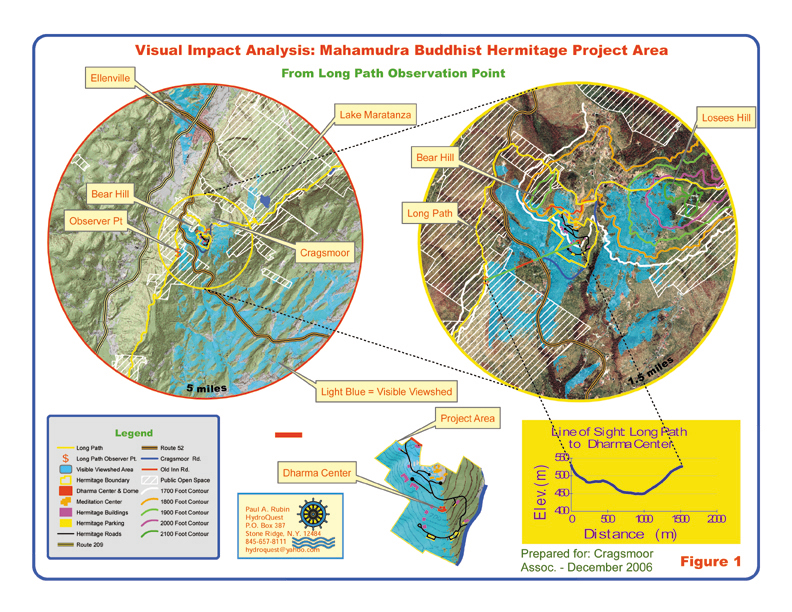
Analysis of Slope, Topography, and Viewsheds
Hydrologic and Geologic Analyses
Portrayal and Analysis of Most Any Spatially-Based Data
Construction of Presentation Graphics
Land Use and Comprehensive Planning
Portrayal of Gas Pipeline Blast Impact Zones
Example Work Project
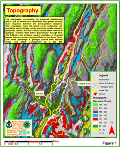
In 2018, HydroQuest completed a detailed hydrologic and geologic assessment of a proposed mining operation that, if permitted, would adversely impact a major water supply spring. GIS maps were constructed to delineate the watershed area and groundwater flow pathways that supply spring flow. This is important from a resource protection standpoint.